Friday, October 9, 2015

To Yosemite We Go

In another exciting, fun filled trip into the wilderness last weekend, Igor and I set out on different paths. Jones-ing to put his body to the test, Igor really wanted to do the hike that we were actually supposed to go on a few weekends back, starting at White Wolf  going through Pate Valley into Glen Aulin. Since that hike was approximately 30 miles and Igor wanted to do it in one day, AHHHHH!, we knew that he would have to go it alone. I pretty much max out around 15 miles and doubling that didn't really seem feasible. Anyhow, we spent the week planning out the logistics of how all this would work and who would carry what. In the end our trails were as follows:

Igor - White Wolf to Glen Aulin via Pate Valley (~30 miles)
Katie - Tuoloumne Meadows to Glen Aulin via nothin', straight shot. (~6 miles)

We negotiated the weight so that I would carry as much as possible, taking off pretty much all the weight from what would usually be in Igor's pack, to increase his chances of making it the whole 30 miles as quickly as possible. So on the way to Glen Aulin our pack weights were:

Igor (< 8 lbs) water, some snacks, and a jacket.
Katie (~42 lbs) - pretty much everything else.

I planned as much as possible in order to make things go smoothly as I could but of course there are always hiccups even in the most flawless of plans. I knew it would be pretty cold out there so we packed accordingly, and there was a 20% chance of rain on Sunday, so we brought out rain coats just in case. On Thursday night we got to Yosemite, the weather had said that the low was to be 48 degrees Thursday night. When we showed up at 7:45PM it was already 48 degrees so we knew that wasn't true. We set up camp and then found a neighbor to share a fire with.

We got up early to get Igor on the trail asap. packed out in a lovely misty fog, that left ice crystals on the ground. It was much colder than 48, but thankfully we were prepared.

I dropped Igor off at White Wolf at 7:15 AM and his journey began on a very cool 32 degree icey morning.
Happy Hiker mile 0

I drove up to Tuoloumne Meadow anticipating that I would get a hot cup of coffee, a warm breakfast and enjoy the cool mountain air before my hike. Much to my surprise all facilities in Tuoloumne Meadows were closed down for the season. The store, the café, that had been their just a few weeks ago were all dismantled. "Oh well, guess that will teach me to brag," I thought, since I had rubbed the prospect of my hot breakfast in Igor's face before letting him loose on the trail ( yeah, yeah I know shame on me).

Anyhow, I got to the ranger station, got the wilderness permit, check, check. Almost ready to go, I tried to fill my water sack up at the water spicket in front of the ranger station... no water, pipes were frozen. hmmmph. I went back inside the rangers station and they told me I could fill it in the bathroom, so I did. Kind of sketchy but whatever, it worked.
Tuoloumne Meadows covered in ice

On a side note, when I picked up the wilderness permit the ranger made sure to tell me to use the restrooms at Glen Aulin, not to just go into the woods. They also mentioned that there would be water up there (that will be key later).

I got to the trail head, packed my pack, which was not entirely easy since I was trying to fit two peoples backpacking gear in my one pack. Got it all in there, barely and set out on my way at 9:10 AM.
Happy Hiker #2 mile 0

I took my time, or at least I thought I took my time, walking the 6 miles to Glen Aulin. It was a really lovely hike on a pretty chilly morning (31 degrees at Tuoloumne Meadow). Ice crystals covered the Meadows like a glistening white blanket and a cool icey mist hung just over the blades of grass.

I bend down a couple of times to take pictures which ended up being an experiment in Katie the human turtle. My pack was so big and heavy that every time I would sit down if I didn't do it just right I would roll over and have to twist and squirm to get back into a position where I could stand back up again. It was pretty hilarious and I am sure that the squirrels and chipmunks were pretty entertained. After awhile I took to calling the pack "Goliath" due to its size and weight.

Katie and Goliath

My hike was fairly uneventful but beautiful. The trail is a relatively flat 6 miles hike, that goes on a steep downward slope the last 2 miles as it drops into the Glen. It follows the Tuoloumne River most of the way and you get gorgeous cascading water falls that start out slowly and then gradually get more dramatic the closer to the Glen you get. It is by far the prettiest hike I have been on in awhile.
Route to Glen Aulin

Snow on the Mountains

Last drop into Glen Aulin

I arrived in Glen Aulin at just before 12 noon and set the pack down. I went straight to the water spicket to fill up my little spare water jug only to find that the spicket had all been removed. Problem number 2..... no water, and guess what, I had left our water filter in the car since the ranger had said there would be water up there (like at May Lake a couple weekends back) so no need for my filter. MISTAKE!! Lesson 1: always bring your water filter, no matter what.

I spent the next hour scoping out the best camping spot and finally decided on one that looked like it would get really nice midday sun, since we were planning on staying here until Sunday, we wanted a good spot. I pitched the tent, then went in search of a water filter from one of the other campers. There weren't a whole lot of campers nearby but I did eventually find a nice group of guys who lent me their water filter several times that day. Turns out that many othes had not brought filters as the rangers had told them the same thing they told me, "there will be water."

I filled up as much water as I had containers for, figuring that when Igor got to camp he would probably be out of water and be very tired. I then went in search of fire wood which proved much more challenging than I had anticipated. There wasn't much goo near by and since it had rained and snowed on Thursday, everything was still rather wet during my Friday afternoon search. I did end up scavenging enough fire wood for the evening and next morning. and set it out to dry in the sun.

I had everything ready by 3 PM for Igor when he showed up. I then went on a walk around to check out the rest of the area and see what was what. There are some awesome pools and waterfalls to hang out by so I did that for awhile, until Igor showed up at 5:30PM!!!

9 hours and 30 minutes of pretty much continuous walking and apparently much more uphill than the several descriptions online that I had read, but he made it al 30 miles and unscathed!. After some much needed rest he related his journey to me which was complete with wildlife sighting of nearly stepping on a snake, nearly running in to a dear, and definitely running out of water for awhile before meeting up with some people who gave him some of theirs.

Overall and eventful and rewarding day for both of us. We stayed up as late as we could chatting with the other campers and deciding what to do in the morning since one of the campers who arrived much later than myself said the chance of rain/snow had risen to 80%.yikes!

When we woke up in the morning it turned out that somewhere on the trail Igor's sleeping mat that was in my pack got a hole in it and he spent most of the night sleeping on the ground instead of his comfy packing mattress. Lesson 2: don't rely on anything that can get a hole in it. We'll be buyng new sleeping mats.

With that in mind and the Ranger who walked into our camp as we were finishing breakfast baring the news that the rain/snow for Sunday morning was up to 90% chance we packed up camp and headed home.
Trail to Glen Aulin

picture that ended in my first experience as an upside down turtle


Sunday, September 27, 2015

Road Trip - Part 2

Continuing the fun, the next day we said good bye to our camp site comrades and hit the road again. We didn't get far before we stopped at a lovely place called "Ragged Point" to grab some coffee and use the facilities. Unfortunately, the facilities were out of order and so port-a-potty it was. All the same, we got to enjoy some lovely views and a quick cup of hot coffee before continuing on the road South.

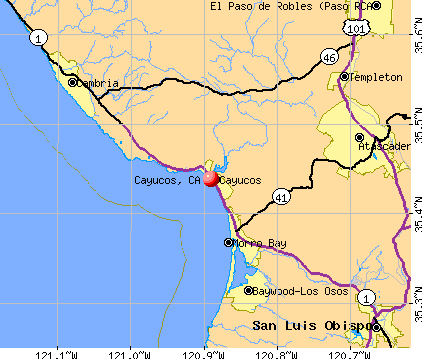
After leaving Ragged Point we called Aunt Dawne and Uncle David, as soon as we got back into mobile phone serve area,  which was about Cayucos, to make plans for dinner.


For as urbanized as California is, there are sure a lot of areas where cell phones don't work still...it's actually kind of impressive. I have two cell phones and two different carries and neither worked after leaving Monterey. FYI, yet another point for the paper map, don't need satellites to find yourself.

Anyways, we finally found ourselves a paper map in Cayucos and Igor got to go for another run on the beach, although he had to wear his shoes this time since he had little blisters on his toes from his Santa Cruz run. I on the other hand went for a swim in the ocean a few times, called my dad to rub in the fact that I was basking in the sun on the beach and just enjoying the sounds of the ocean. I also got the great surprise of a dolphin show just off the shoreline. About 6 dolphins playing in the waves, jumping and swimming. (sorry no pictures) but it was spectacular!

With one last dip in the ocean before heading out again to make it to Riverside by 7:30 PM, we were off. We stopped a few more times to see some elephant seals (man do they smell ripe!) and for a quick lunch in Solvang and arrived right on time to grab dinner with Aunt Dawne and Uncle David. We had a wonderful dinner and evening with them, burning late into the midnight oil.

The rest of our trip was some what less exciting but we did get to go to Disneyland on Monday. Igor's first and maybe last time at Disneyland, I don't think he really enjoyed it that much, and the enjoyment was a little more stifled as I got motion sick and couldn't enjoy the rides nearly as much as I should have. But overall it was a great trip and now you get to enjoy some of our photos!


Stinky Elephant Seals
 
Aunt Dawne & Uncle David's lovely House
Backyard Tree Swing, Igor thinks needs to be scarier.


HWY 1 Road Trip - Part 1


The last time I was on HWY 1 I was with my dad and possibly my sister....though I don't entirely remember her being there. All the same I have little, if any memory of it. So when work decided that I needed to go to a conference in Anaheim (near Disneyland), Igor decided he wanted to come with me and for kicks we would drive the long way down!

I rented a car and we loaded it up, not so early on Saturday morning with no particular plan in mind (I'm working hard a getting better at this). We put the rubber to the road around 11 AM and headed over the bridge into San Francisco, our first stop the sunny beach city of Santa Cruz.

One interesting fact about finding the route down HWY 1 is that, despite my best efforts I could not get google maps or the waze app to take me that route or even give me that option. I guess that just goes to show you that technology is no real substitute for a map.

We made it to Santa Cruz around 1PM and found a parking spot about 5 minutes walk from the Board Walk. Since our trip down to San Diego a couple of months ago Igor has been really wanting to go running on the beach again. Something about the sand under his feet and the beauty of the ocean means freedom and he loves it. So avoiding the participants of the Ironman competition that was still underway Igor handed me his sandles and away he went running down the beach. I decided that a lovely stroll was a better way to enjoy the warm day and so took my time walking in the wet sand and letting the waves lap at my feet.

Eventually we met back up and got back on the road. Our next stop, Monterey! Initially we thought that maybe we would check out the aquarium but when we arrived at about 3:00 in the afternoon we though the better of it for this trip as we still needed to make it quite a bit further along the road before finding a place to sleep that night. So in Monterey we found a cute little café market place and had a nice, hot, and pretty late lunch, complete with hot chocolate and coffee for the road. :)
Monterey Hot Chocolate in Hand

We stopped a few more times along the highway to take some pictures and enjoy the scenery when it got more dramatic. Even decided to be daring enough to climb down a small part of a kind of precarious cliff to take some pictures.


As you all know, I am not the most spontaneous of people, though I am trying to enjoy the unknown a little more. On this trip I decided to embrace it and didn't make any reservations to stay anywhere for the first two nights while we drove down the coast.

When it was getting late and time for us to start looking for a place to stay for the night the discomfort of not knowing was eking in on me a bit. We passed through Big Sur and south all the camp grounds (and there were quite a few) had signs posted out front "FULL." So with the sun setting, Igor and I stopped the car and went down to the beach at the side of the road to enjoy the sunset. Igor found a nice spot where he wanted to camp for the night and I, of course got nervous about the fact that we probably weren't allowed to stay there. I still don't know if it's legal or not, even after conducting some research online.

We drove a little further down the road to get some water and discuss what to do a little more. We stopped a very nice little camp ground that of course was full and filled up our water bottles for the night. Igor could tell that I was growing more uncomfortable with our beach sleeping plan so he decided to go ask some people if instead we could share their camp site. The first couple he asked said "of course!" and we ended up having a wonderful evening and morning with them. They even had extra food that they shared with us and some fun stories about their camping experiences up in Weaver, Ca, complete with potential sasquatch characters!

Jerry & Sabrina, our camp site saviours

Monday, September 7, 2015

Backpacking Lessons from Ten to May

This trip we learned some additional lessons:
  • Trying to make yourself sleep doesn't work
  • Katie needs to drink more water on the trail
  • Katie needs to eat more on the trail
  • Sometimes not having a plan gives you wonderful surprises
  • It's ok to bail early, s*$t happens
  • Switch backs don't get easier (at least not in 2 weeks time)
  • Getting a good night sleep is important
  • Igor needs a warmer sleeping bag
  • Weather changes (bring clothes for all weather, leave them in the car or bear locker but at least you have options when you get there)
  • Plans change, even if your permit doesn't
  • Know your limits
  • 60+ year olds can still kick young ones butts
Until our next trip...aka car camping from San Francisco to Anaheim via HWY 1 next weekend!!

http://blog.hostelbookers.com/destinations/north-america/usa-road-trip-san-fran/

Yosemite without a Plan

For this fine Labor day weekend, after a long week at work Igor and I had decided to go back to Yosemite, almost immediately after getting home from our last trip. (disclaimer none of the below pictures are mine. I need to find a lighter camera).

Lesson's we learned on our previous trip:
  • our tent is too heavy
  • our pots are too heavy
  • Igor's sleeping bag is too light for almost all situation
  • we didn't need to bring so many power bars
  • hill climbing switchbacks are not Katie's cup of tea
  • get a camp ground in advance so you don't have to swipe one (shhhh!) is always a good idea

With those things in mind, we prepared for a our trip back to Yosemite this weekend, braving the fires and the plague yet again. We had to get the breaks on the car fixed as they were giving us a rather bumpy down hill ride on the way home the last time and the tires needed to be replaced too, oy. So after a long week of errands and running around trying to get things fixed on top of craziness at work, we thought we were ready.

We got a much lighter tent 1.1 LBS instead of 6.8 (Hurray!!! Katie's pack is lighter), ditched the heavier pots for an X pot, 

got Igor a warmer sleeping bag and off we went on Thursday night.

We arrived pretty late to Tuolumne Meadows campground, well after dark, set up our little light weight tent and tucked in for the night. It was pretty dang cold, much colder than we had anticipated and Tuolumne Meadows ranger station is much more popular than we thought. We woke up in the morning to a very chilly camp, got dressed and headed over to the ranger station to get our permits for our 4 day trip only to find there were people already lined up for permits tomorrow and every trail heading south into the Valley was taken....

We asked the rangers what we trail we could do, if any, leaving Tuolumne Meadows and their response was yes, one, Dana Meadows to Parker Pass down through Gem Lake to Waugh Lake then up Lyell Canyon to Tuolumne Meadows (TM). Ok, sounds good, right? Nope. But we took the permits and headed to eat breakfast and get some hot beverages to warm up our freezing hands.

The first 20 miles of this trail are all well above the "fire line," the 9,600 ft regulation for allowing camp fires, that means no warm fire for the first 2 days. To add to this, where Igor had bought himself a nice, new, warmer sleeping bag, the lower limit on that bag is still only 23F and at TM (~8,700 ft) it had been 29 degrees (so that's why we were cold!!), add another couple of thousand feet and it was going to be really, really cold. We had not packed for icey weather, Igor only had a light jacket, and I had a vest and fleece, not near warm enough for that kind of cold. I always have a poofy down jacket in the trunk off the car, which ended up being a blessing on this trip (yeah for Katie leaving extra clothes in the car!), but even assuming that it would be colder, we had not planned on it being that much colder than 2 weeks ago. Oh what a difference a day makes!  Or in this case two weeks.
Dana Meadows to TM (36+ miles) first fire location Gem Lake

So after some discussion over breakfast about the permit we decided to go back to the ranger station and see if we could get a permit for any other trails that were perhaps going North instead of South out of TM. If all else failed we would do a day hike and then go home. Turns out,we were in luck, and yep, there were permits available going North. So after some bickering with the Ranger about being allowed or not allowed to change the direction we walked the trail in, we set out to go from White Wolf via Luken Lakes and exit at White Wolf, except we didn't exactly.
What we were supposed to do, no May Lake here...

After a long morning and a late start we hit the trail at 12:20 PM knowing we had to make it at least 10 miles before sun down at 8 PM. So we huffed it. This hike already had better scenery than our last hike and being a Holiday weekend and all, there were quite a few people on the trail, most of whom were French. At about 5:30ish we arrived at our first destination, with Katie having pretty tired legs after a lovely switch back climb just before dropping into the Ten Lakes Valley.

Ten Lakes is beautiful, let's lead with that. We set up camp just above the lake, there were probably 20 + other hikers around so it was a little more like being in a camp ground than out in the wild, but it was still lovely. I went to down to the lake to filter some water and got a sunset show as a family of deer came out of the woods across the lake from me and were having a nice little dinner. We started a small camp fire to keep warm, had a rather heated discussion about not having enough room in the bear canister to store the trash and what to do about it. Resolved to hide it as best we could in a rock pile and went to bed aiming to get up in the morning and walk 15 miles to May Lake.
 we were camped just where you see the reflection of the mountain (http://www.americansouthwest.net/california/yosemite/ten-lakes10_l.html)

Per usual, I had a pretty hard time sleeping, but this one was worse than in the past as my ears were aching, my head was pounding and I was sweating like no other. Way too warm in my sleeping bag to the point that I got down to just my skivvies, and ultimately got about 3 - 4 hours of sleep, I was not a happy camper. In the morning my ears still hurt, my head still ached, I felt sick to my stomach and eating breakfast proved to be a challenge, but I got through it, we packed up camp and headed out onto the trail.

Ten Lakes to May Lake is a gorgeous trail, it has high peaks, picturesque meadows, exposed granite passes, rivers and lakes, it's got a little bit of everything, including more than it's fair share of switchbacks. Oh yes, lots of those. Our first bit of hiking for the day was a set of not so terrible switchbacks going out of the Ten Lakes valley, then switchbacks down into a small valley cut through by South Fork Cathedral Creek, which was barely running. This lead into switchbacks up, then a small number of switch backs down, then some very appreciated flat, through a meadow. From there another set of by this point gruelling switchbacks up to a pass nearly to the top of Tuolumne Peak. At this point the trail goes into another meadow, and then moves into switchbacks down into the valley where there is a decision point in the trail: Polly Dome Lakes or May Lake.

By the time we hit the decision point my legs were shot, my head ache and ear ache were thankfully gone, but I am pooped. Igor and I rest and discuss our action plan. I told him that I was not sure that I could make it to May Lake in the amount of time we had before dark, 3.5 miles in 4 hours. And after some food, more rest and discussion. I decide I would give it a try, it's only 3.5 more miles after all! And since our pace to that point had been a mile every 30 minutes I figured we could go a lot slower and it would make it a little easier. Little did I know, or rather little did I want to believe, that I would have to climb 2 more passes before getting to May Lake.

We got back on the trail, Igor did tell me that he thought we were going to have to go through 2 passes and even pointed to them, but I said "No way is that possible, we wont have to do that, it doesn't make sense." I wish sometimes I would be right about these things, but I'm not. I'm not so much so that I told Igor while climbing the second to last set of switch backs: "You know when you say things like, 'I think we have to go through 2 more passes, or over that ridge' I wish you would be wrong once and a while!". And in this tone there some not so nice words uttered by me, to myself about how come hiking up is so hard, how we always seem to end up in these situation, and my all time favorite tune of "never again!"

Funny picture of the trail from someone I can relate to! (http://www.outbackadventures.com/gallery/Yosemite-Ten-Lakes/IMG_0665)


But all the pain and fatigue was well worth the trouble as we walked into the May Lake backpackers camp. What a wonderful evening we had! Igor met some nice people from San Jose (a group of 15 adults and teenagers) while looking for a more suitable tent spot. We ended up joining them for dinner and camp fire games. Do any of you know what's "Behind the Green Glass Door"? We had a splendid evening and got some great advice on where to go for the rest of our trip.

May Lake, what we woke up to (https://commons.wikimedia.org/wiki/File:Yosemite_29_bg_090504.jpg)

In the morning after a much, much better night of sleep we joined another group of campers for breakfast. Turns out some of them (all 60+ probably) had done almost the same hike as Igor and I, yesterday. We had seen them in May Lake setting up their tents just as we arrived the night before, so they must not have been too far ahead of us, but man, they didn't look tired at all!? How is that even possible?! Katie = dead on foot, 60+ year olds drinking and having a grand old time, after the same hike...so not fair.

As we were finishing our breakfast, Igor was packing up the food and all of a sudden, I almost loose my breakfast, and then again. I stand up walk a little and then almost loose it again. My head feeling funny, my tummy a mess, we finished packing out our gear. We walk down to the May Lake parking area near Tioga Road, and I need to stop at the restroom. Not good. Definitely in no shape to walk 10 miles to Glen Aulin like we had planned the night before. Instead, Igor, the amazing man that he is, decides for me (since I really did want to go to Glen Aulin and was stuck in the mist of indecision) that "Nope, we're going back to the car."  So, we walked the 2 miles down to Tioga Road. Igor hitcched a ride in the first car that came up to get back to the trailhead where our car was parked, and we headed home a day early and a little disappointed.

Definitely not the trip we had planned, and I would love to try it again under different circumstances, but this way we have something to go back and do. And we are already looking forward to our next trip, whenever that may be. Glen Aulin here we come....eventually.

P.S. I am doing better a day later, still not perfect, heads still a little woozy, and feeling a little weak, but much better than before.

Our actual route

Saturday, August 29, 2015

Fall

It's amazing how you can go to bed one night, wake up the next morning and all of a sudden, the light has changed and it's Autumn.

It has left me feeling very nostalgic, longing for Exmoor, and my friends in England.

Rockford Inn - Where our great adventure as an MA class started Oct. 2009

Tuesday, August 25, 2015

ADVENTURE!!! - Part 2

Lesson 3: It will all be OK, DON'T worry.
After about 30 minutes of rest Igor reluctantly tells me we need to get going. I begrudgingly put back on my pack. Just so we are clear Igor's pack was quite a bit heavier than mine. He had our camp stove, fuel, pots, food (mostly trail mix and space food), bear canister, which may beg the question, what the heck was I carrying. I had our toiletries and liquids (not that heavy), potty stuff (not heavy), the water filter (not heavy), and the tent (6.8 lbs). Some how we were still packed quite on the heavy side even though both of us only brought a minimal amount of clothing. We are working out how to lighten our packs for next time.

Anyway, we got back on the trail. Igor ambitiously thought that we could make it 12 miles to the Upper Merced Pass Lakes. I on the other hand had serious doubts based on the state of my legs after the butt shaping Four Mile Trail. We agreed to try and get as far as we could. Oh and by the way Igor at this point still believed that we could do the 50 mile Red Peak Loop trail, I on the other hand, knew that was out, at least this time based on how tired I was, our late-ish start (10:20 am) and our food situation (only enough to last us 'til Monday afternoon). We walked and walked. By about 4 PM I had very little left in my legs, so we decided to try to get from the trail marker at Illiouette Creek to the next water source, just under 2 miles away. This plan would have been perfect but... As we are approaching our desired spot, I keep thinking that we should be soon following a medium sized creek. I keep waiting. We keep walking but all I am seeing is lush green vegetation in what might have been a creek and hoping that I am wrong that we just haven't hit where the creek is yet. I keep thinking, "maybe I just misjudged how far it was on the map." But the further we go, the deeper that feeling gets that this vegetation is where the creek used to be. Sure enough when we get to what used to be the crossing we are struck with a new problem. The creek is dried up.

So what do you do when there isn't any water where you thought there would be?

Well in our case we had 2 choices: walk the 2 miles back to where the way we came where the other water source was, or keep walking to the next water source. I put my faith in Igor's judgement and we walked on. At 6:30 PM, about a mile further down the path we found it!! WATER! and just in time, as we found discovered when we took off our packs and found that neither of us had any water left. Igor found the perfect camp site for us, previous tenants had left us wood and a lovely circle of benches to sit on. I went and filtered us some water. Igor started our food and I set up the tent. We had a lovely, all be it short evening, hitting the sack at 9 PM, with a new plan in mind.

Lesson 4: Day Trips can be just as hard/fun as a loop trail
In the morning we took our time making our breakfast and getting ready of our day. We had decided the night before that the 50 mile Loop to Red Peak Pass was out this time and that we would do a day trip to the Upper and Lower Merced Pass Lakes. With that in mind, we hit the trail at 9:30. As we walked the 6.5 miles to the Lakes the subject kept returning to how glad we were to have found the water and how glad we were that we didn't decide to keep going. Igor admitted that even he would have had to push to get up to the Ottoway Lakes 3 miles further up the trail from the Merced Lakes.

We had a great day of it, stopped at a cascaded river pool system and went for a quick dip! Then on again to the Lakes where we had to climb through a rock slide boulder field to get to the little rock cropping where we dove into the icy water and had a great lunch.
We made it back to the camp by 6:00 PM, total of approximately 15 miles round trip made for a very long day but it was lots of fun.

Picture from our lunch spot
Looking out on some mountains from lunch

Lesson 5: You're Stronger than you think
On our last night, after our Lake day I ended up with a bloody nose. I am not sure how many people know this, for sure Aunt Dawne and Uncle David as they have experienced backpacking with me before, but I am afraid of sleep out in the wilderness. I don't sleep well as I am on auditory overload and ever sound makes me jump. Well as Igor was kind enough to inform me when I told him about my bloody nose:
Igor: "You're joking, right?!"
Me: "No seriously, look" shows bloody nose
Igor: Looks very serious "You know that wolf you were afraid of last time, animals like that are actually attracted to blood, so that might be a valid concern now."

I still don't know if he was kidding or not but needless to say I was not able to fall asleep for a good couple of hours, until I was convinced that any animal that wanted to come a get me would have done so by now.

Monday morning we woke up. We took our time packing out, had a lovely breakfast of our remaining food and packed up our camp. Double checked our camp site, said good bye and started the 9 mile walk down to the Valley floor.

The first four miles had some really large downed trees that we had to roll or jump over. Even with our packs slightly lighter, it wasn't exactly the easiest thing and the trail went through some areas that if there was actually water where there was supposed to be, it would have been challenging to cross. We made it to where the trail split to Nevada Falls in 2 hours, averaging 30 mins a mile, which is a pretty quick pace. That's where things got hard for me. We had done a lot of down hill come out of the Lakes the day before and my bumb knee from forever ago had started aching. When we hit the 4000ft descent to the Valley from via Vernal Falls my knee was in full ache mode.

After two miles of this with my 35 lbs pack:

my poor little knee and legs were about to buckle. I made it down the stairs with legs shaking so bad they were barely working and even walking on flat surfaces, Igor said "they looked shaky and almost deformed, the way you were walking." I had a mini emotional break, not sure why, but after a few minutes of rest I was fine. I got back up on to my shaky legs and ran down the hill, which sounds counter intuitive but really it was easier to free run, than trying to control each step. 

Anyways, we made it down to the valley floor by 1:30-ish!!! 9 miles in approximately 4 hours and yes it was almost "break neck speed." We walked all the way back to Curry Village were we had parked the car, took off our boots, both blistered and tired we got into the car, happy to finally get to sit and started our drive home by 2PM.

P.S. It was over 80 degrees the whole time we were there even up at 8,000 ft. eww. There were fires outside the park to the South and apparently 2 people have gotten the plague, yes "that" plague, you know the one from the 1300's that wiped out 1/3 of Europe's population. But not to worry so far we are fine and with 30,000 people a day visiting Yosemite to only have 2 people who have contracted it, I would say were are going to be fine. (our full trail here http://www.wandermap.net/en/route/create/#/z11/37.73216,-119.55596/terrain)

Here are some more of our pictures. 
Tired backpackers leaving Yosemite


ADVENTURE!!!! - Part 1

What do you do when you decide to take a spur of the moment backpacking trip through Yosemite? Just get in the car and go! With little in mind other than to get into the back country of Yosemite and no particular trail picked out, Igor and I got in the car and headed out Friday afternoon to the great, wide, beautiful Yosemite. Two years and a few months from our last visit which you may remember was full of new and crazy experience such as Katie the Nativgator, Trail Guide, and Proctor Extrodinar, what happens when one of your crew gets altitude sickness, and what not to bring on a backpacking trip, our journey this time was full of equally exciting experience.

Yosemite Lessons

Lesson 1: Don't worry, it will be ok

I am going to preface this all by saying that I usually need/like to have a plan. I am told that my dad loved to not plan things, just spontaneously get on the road and go... Not sure if that is true or not but he can attest or deny and he sees fit. Well, Igor is much like my dad in this case, as he finds it exciting and challenging to charge in, no particular plan in mind. So I decide to take a page out of their book when Igor suggested on Monday night that we take our much anticipated, much postponed backpacking trip to Yosemite. We have been trying to go back since May but something always got in the way, work, getting sick, climbing trips, etc. Anyway, I was so busy at work that I really didn't have the time or the desire to plan this trip to Yosemite so when we got in the car Friday afternoon I knew of 2 possible trails we could take, and no place to stay, but figured that we would just ask the Rangers.

While making the 4+ hour traffic filled drive to Yosemite, I fessed up to Igor that I really had no plan and that I didn't even know where we were going to stay when we got there because I didn't make us a reservation at a campground. As is his way Igor simply said, "We'll figure it out, don't worry." I unfortunately...or fortunately come from a line of particularly adapt worriers. Don't try to refute it, I know who you are. lol Let's just say I was a little stressed out not knowing where we were going to sleep when we got to the gates at the park entrance and they had a lovely sign that said " All Campgrounds Full."

So I followed Igor's lead and we went to the Valley anyway, hoping to find something, or somewhere to sleep. Apparently it is illegal to sleep in your car in Yosemite, and no we didn't find that out the hard way. It turns out that one of our acquaintances from the climbing gym was there as well and we ran into them at the general store. After some talking, they made some suggestions to us on what to do. We ended up finding a campsite and sleeping quite happily.

Lesson 2: Know Your Limits
We woke up Saturday morning, got to the wilderness center at 8:00 AM to get our Wilderness permits to go into the back country. After a particularly long speech about how to leave no trace by a new park ranger, which included some new policies by Yosemite since last time we went such as:

  • hanging food in a tree isn't a valid method of bear prevention, 
  • you have to have an impermeable surface under your tent, and best of all,
  • pack out your TP, yes even the special backpacking kind (ewwww)
We got inside finally after 30 minutes of wilderness "training",  to get our  permits. This is where it gets a bit sketch. Since I didn't really know which trail to take I tried asking the ranger helping us. Other than seeming very annoyed with all my questions He pointed us towards Red Peak and Ottoway Lakes. So we decided on the Glacier Point to Illiouette Creek - Ottaway Lakes Trail. I didn't know that you had to specify an exit point but the ranger was insistent so we were supposed to come out at Glacier Pass, which would have been a 50 mile loop. With permits in hand we got coffee, ate our breakfast, got in the car when Igor asked the all important question:
Igor - "Ok where do we go?"...
Katie - "Trail head = Glacier Point - Illiouette"
Igor - "Where is that?"
Katie - deer in headlights look "Umm... at the trailhead?"
Igor - "Ok, but where is that?"
Katie - messing with GPS, only thing that comes up shows top of Glacier Point 1 hr 5 min drive from Valley floor "I don't know, the GPS doesn't show it."
Igor - "Isn't that something that you should have asked the guy when you got the permit?"
Katie - "Umm... well, I... uhh"
Igor - "Whatever let's just go back and ask, right?"

So we go back to ask. Turns out it is a 1 hr 5 min drive to the trail head, at the top of Glacier Point. So my brilliant idea, let's just take the "Four mile trail" up to Glacier Point from the Valley.

Here is the Yosemite Hiker description of the Four- mile Trail

"Difficulty:  Call it a 4 out of 10 going down and 7 out of 10 going up. The trail is wide and smooth, and not nearly so steep as Upper Yosemite Falls, whose own valley-floor-to-valley-rim trail is a mile shorter. By the time you finish the second set of switchbacks on the way up, though, you'll know you've been on a hike." (http://www.yosemitehikes.com/yosemite-valley/four-mile-trail/four-mile-trail.htm)


This is a rather deceiving description, it may not be the "Mist Trail" to Nevada Falls, which if I had ever walked up would hit a 10 out of 10 for me, and I have not done the Upper Yosemite Falls trail, but if it's harder than the Four-Mile Trail booty buster, I will not even consider it with a 35lbs pack on my back. This Four Mile Trail was still one of the most challenging hikes of my life.

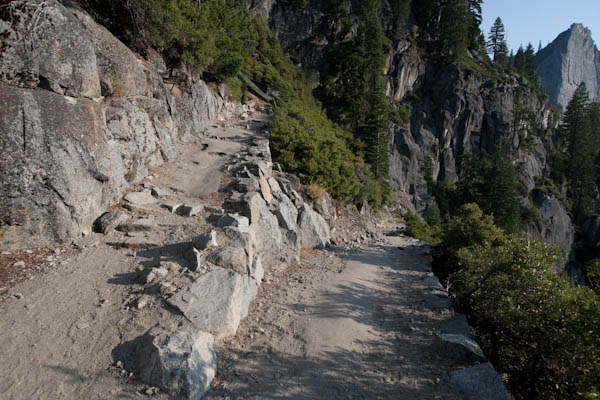
The name should be "almost 5 mile switch backs to make you seriously question your personal resolve and reason of continuing Trail." It took me over 4 hours to walk up the 4.6 miles, 3,200 ft elevation gain, during which I had serious discussion with myself about not being a quitter, about my options none of which were being able to stay where I was, and having to push myself ever step of the way up, to the point that I was counting my steps at the very end "1, 2, 3, 4, ...30. ok Now 30 more.." See Google earth image of the trail:


I had a cheering squad of various different hikers from all over the world who were fabulously encouraging including the one South African gentleman, in a lovely bright green shirt, 0.6 miles from the top who let me know that Igor, whom I had told to go ahead of me, was "not that far in front of you and don't worry, he's sweating too." HAHAHA I loved it. It definitely put a smile on my very tired face. 

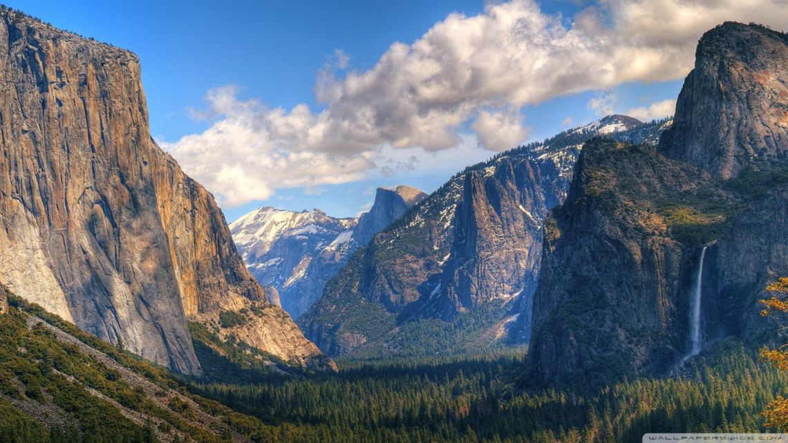
I did make it to the top and had Igor waiting for me there to take a break and enjoy the scenery, which was spectacular and I wish I could have enjoyed it a little more. It's the best glut work out I have ever had and I seriously could have been done for the day at that spot. The trail did have some amazing views on the Valley, especially from the top (Glacier Point). (Mom, avert Emery's eyes he will have vertigo). FYI these are not my pictures as I didn't bring a camera, other than my phone with me, and all my concentration was on just trying to make it up the hill.